Sunday Solo Run

groovebus

Member
I usually don't go out on my own, however the Main Divide Road of the Santa Ana Mountains is a pretty well traveled truck trail. My usual co-pilot was out of town. 23 miles in 3.5 hours. Here are a few pics:


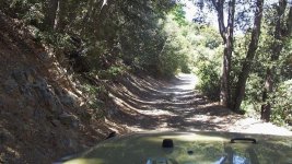
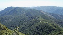
Main Divide Road from Ortega Hwy close to Lake Elsinor. That is the road I just came up
RoadBehindMe.jpg

Lots of little hidden gems
TheRoad.jpg

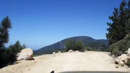
Almost to Santiago Peak
SantiagoPeak.jpg

There was a nice Wrangler parked at the top. No driver, probably out hiking. Mine is the one with the jolly roger spare cover.
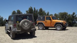
FoundJeep.jpg

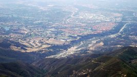
Trabuco creek and Mission Viejo
TrabucoCanyonFromDivideRd.jpg

Little Flex Shot, should have got a better angle
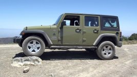
Flex.jpg

New pinstripes. Wife was kind of pissed since I just got it in January
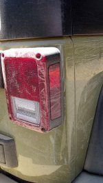
PinStripes.jpg

I told her I don't mind if I caused the scratches, but if someone dings my door in a parking lot I would kick their butts.
 
Last edited:
I usually don't go out on my own, however the Main Divide Road of the Santa Ana Mountains is a pretty well traveled truck trail. My usual co-pilot was out of town. 23 miles in 3.5 hours. Here are a few pics:


Main Divide Road from Ortega Hwy close to Lake Elsinor. That is the road I just came up
View attachment 30803

Lots of little hidden gems
View attachment 30805

Almost to Santiago Peak
View attachment 30804

There was a nice Wrangler parked at the top. No driver, probably out hiking. Mine is the one with the jolly roger spare cover.
View attachment 30801

Trabuco creek and Mission Viejo
View attachment 30806

Little Flex Shot, should have got a better angle
View attachment 30800

New pinstripes. Wife was kind of pissed since I just got it in January
View attachment 30802

I told her I don't mind if I caused the scratches, but if someone dings my door in a parking lot I would kick their butts.

Nice, run. I haven't been to the top in years. If you look really close you can see my house.:):):):eek:

Sent from my EVO using WAYALIFE mobile app
 
It was nice and relaxing. Nobody but me and my Jeep. The only scary point was when I rounded a turn on a really narrow part of the road and a really big Suburban, or maybe it was a Tahoe, was coming the other way. I had a choise, inch up to the edge or go into the brush. I chose the brush, I figured it would cause less damage than a 2000 ft roll down a mountain. I got some new pinstrips out of the deal. LOL
 
It was nice and relaxing. Nobody but me and my Jeep. The only scary point was when I rounded a turn on a really narrow part of the road and a really big Suburban, or maybe it was a Tahoe, was coming the other way. I had a choise, inch up to the edge or go into the brush. I chose the brush, I figured it would cause less damage than a 2000 ft roll down a mountain. I got some new pinstrips out of the deal. LOL

Nice, that's called battle scars. Girls love it!:cheesy:
 
Nice run where does this trail start at exactly I might go check it out

It's a little tricky to find. The way I went this time is from Lake Elsinor CA onto Ortega Hwy (Hwy 74 in South Orange County) to NF-6S05 or Long Canyon. There is no road signs for the turn, it was just a yellow intersection sign between the Carizo fire station and Decker Canyon. The trail is called the N. Main Divide Road. I went up and over the top of Santiago Peak and went down Maple Springs road into Silverado Canyon and came out onto Santiago Canyon Road. During fire season the whole mountain is basically gated off. The road isn't to tricky, just narrow in spots and a few ruts and lots of loose rock. It took about 3.5 hours to make the 23 miles from pavement to pavement.
 
Last edited:
You had a nice clear day! I went in November and was in the clouds... which was cool too.

DSC_9121.jpg


That's the very summit of Modjeska Peak (the left peak of Saddleback looking from OC). The last mile of trail off the main road to that summit is a little rough... but not a problem.
 
Top Bottom