You are using an out of date browser. It may not display this or other websites correctly.
You should upgrade or use an alternative browser.
You should upgrade or use an alternative browser.
TRAIL TUESDAY : Let's See Pics from Your Favorite Trail!
- Thread starter wayoflife
- Start date
GraniteCrystal
New member
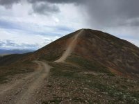
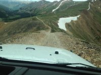
Definitely Red Cone!
Theres just no getting away from that downhill section coming off the summit. Major pucker.
Just checking, that's Red Cone just south of Breckenridge? I'm taking a buddy on a multi day trip and looks like I may need to add that to our route
boardsurfer
Active Member
Just checking, that's Red Cone just south of Breckenridge? I'm taking a buddy on a multi day trip and looks like I may need to add that to our route
Actually East of Breckenridge, but you have to go a ways south to get around to the trailhead. Not to be confused with Twin Cone which is just on the other side of the highway 285 to the south. Red Cone is an excellent trail with one or two spots that are as easy or difficult as you want them to be. When you come off the summit, you can go left to pick up Webster Pass trail which goes back to where you started, or go right to go down into the valley and pick up Radical Hill:
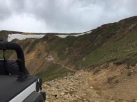
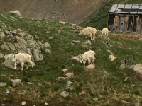
Radical hill is short, high pucker factor and leads you back to the high ridge line. From there, down into the next valley (there are 2 or 3 different ways down) that drops you off in Montezuma, right next to Keystone resort. If you wan to stay as high altitude as possible, take Saints John after Radical Hill. It ends in generally the same area as the others. Heres what that looks like (Radical Hill is that purple bit in the middle):
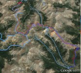
One last tidbit - Coming off the summit of Red Cone is ONE WAY ONLY. If you want to get up there, you can only do it from south to north.
Last edited:
catahoula
Caught the Bug
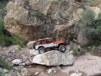
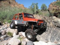
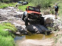
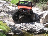
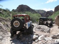
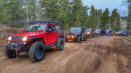
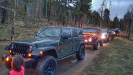
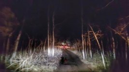
These are some shots from the 'famous' Coney Flats water crossing around here on the Middle St Vrain/Coney Flats trail. These are the only photos I have access to right now and they aren't very high quality. For a vehicle like mine, the trail is moderate to difficult, but probably one of the most challenging in this area. It's not too bad really, most obstacles can be bypassed or just take a good line. The area is beautiful, lined with pine trees and a fair chance of seeing of wildlife. These shots were taken in late August when the water is typically the lowest. It's a fairly long trail, so you feel like you get a good half day out away from the busyness of life.
View attachment 183269View attachment 183266View attachment 183267View attachment 183268
Man, I would love to have a rig like yours!:beer:
catahoula
Caught the Bug
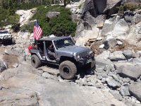
Recently ran Smiley Rock here in AZ with a great group of Jeepers and the trail quickly became one of my favorites. We had a great opportunity to run it covered in snow which increased the challenges as well as the excitement. Thanks to Arizona, TheFunSmith, Rex, and firecrew1 for a great day!
I swore RDE2ROCK took a pic of that WAYALIF plate.
GraniteCrystal
New member
One last tidbit - Coming off the summit of Red Cone is ONE WAY ONLY. If you want to get up there, you can only do it from south to north.
Awesome! Thanks for the Intel. It's definitely getting added to the list of trails for our 4 day trip. If you have any other suggestions I'd love to hear them. We're leaving from Denver and doing a 4 day loop in July.
boardsurfer
Active Member
Awesome! Thanks for the Intel. It's definitely getting added to the list of trails for our 4 day trip. If you have any other suggestions I'd love to hear them. We're leaving from Denver and doing a 4 day loop in July.
Red elephant hill to Bill Moore Lake is a great combo. You're familiar with Traildamage.com right? Awesome resource.
GraniteCrystal
New member
Red elephant hill to Bill Moore Lake is a great combo. You're familiar with Traildamage.com right? Awesome resource.
Just looked those up. They look great; I'll add them to the list.
And yes, was introduced to Trail Damage thru the forum.
Thanks for the ideas!
Here are a few shots from Genoa Peak overlooking Lake Tahoe.


GraniteCrystal
New member
Sheesh. That's epic. Great shots Cindy. Wish I had your eye (or at least your equipment!)
swampdog
New member
Here are a few shots from Genoa Peak overlooking Lake Tahoe.


These are my favorite pictures I've seen you post lately. Great stuff. The rock formation makes the rig look much more rugged, if that is possible.
Brute
Hooked
These are some shots from the 'famous' Coney Flats water crossing around here on the Middle St Vrain/Coney Flats trail. These are the only photos I have access to right now and they aren't very high quality. For a vehicle like mine, the trail is moderate to difficult, but probably one of the most challenging in this area. It's not too bad really, most obstacles can be bypassed or just take a good line. The area is beautiful, lined with pine trees and a fair chance of seeing of wildlife. These shots were taken in late August when the water is typically the lowest. It's a fairly long trail, so you feel like you get a good half day out away from the busyness of life.
View attachment 183269View attachment 183266View attachment 183267View attachment 183268
I think you need to install a couple rod holders for trolling...
On my bucket list is to catch a fish while in the drivers seat of my rig while it's in the water...this looks like a good place to do that...
Brute
Hooked
Here are a few shots from Genoa Peak overlooking Lake Tahoe.


Might be one of the best composed photos of a rig anywhere...the lighting really makes it special...
WJCO
Meme King
I think you need to install a couple rod holders for trolling...
On my bucket list is to catch a fish while in the drivers seat of my rig while it's in the water...this looks like a good place to do that...
That would be cool. Of course, not sure how many fish are going to hang around their habitat while a Jeep moves through it, lol. You never know though.
WJCO
Meme King
Cool photo.

