ClarksAdventures
New member
Good to know about the maps at the forest center. I was going to go there and check it out anyways.
I printed off the online map but had a hard time as it had to be broken up into 6 sections so you could at least see it.
Did the thing with Garmin custom maps where you can transport a map into your Garmin handheld and it will be in there. It came out okay but some of it is off several hundred feet.
I think part of it is because one map is hand drawn and the other is actual aerial imaging.
Never could get that .KML file to work that they provide on the web site. Does anybody know how to load that into a Garmin handheld with Garmin's Base Camp software?
I also sat there for a long time and used Google Earth and their map back and forth to get the GPS coordinates to each trail I am capable of running.
Yeah I am OCD about maps, but I spend a lot of time on our BLM and Forest Service roads that lace Oregon like a spider web.
Still want to see the photos of your buddies place. Talk about a cool idea!
Sounds like you're ready to be our trail navigator for the group on Saturday!


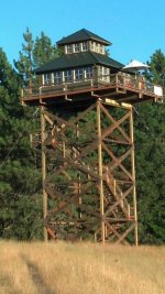
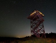
This is the rough place I have to spend a week or two every year. The forest service lookouts aren't quite as nice. Haha
